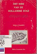
Het Idee Van De Hollandse Stad
Het boek Het Idee Van De Hollandse Stad verkent het concept en de ontwikkeling van steden in Nederland, met de nadruk op de kenmerken die de steden in Holland onderscheiden van andere gebieden. Egb…
- Edisi
- Ed. 1, Cet. 1
- ISBN/ISSN
- -
- Deskripsi Fisik
- 247 hal.; ilus.; 16,2 x 22 cm.
- Judul Seri
- -
- No. Panggil
- 711 HOO h
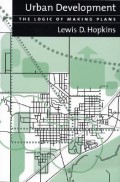
Urban Development: The Logic of Making Plans
The book Urban Development: The Logic of Making Plans discusses the fundamental principles and logic behind urban planning. Lewis D. Hopkins outlines the planning process as a system involving data…
- Edisi
- Ed. 1, Cet. 10
- ISBN/ISSN
- 1-55963-852-4
- Deskripsi Fisik
- xvi, 292 hal.; ilus.; 15,2 x 23 cm.; indeks.
- Judul Seri
- -
- No. Panggil
- 711.4 HOP u
Cities of Peasants: Exploration in Urban Analysis
This volume is intended to be introductory. Although the range and historical depth of the material make the theme complex, I have tried to present the argument as simply and coherently as possible…
- Edisi
- Ed. 1, Cet. 1
- ISBN/ISSN
- 0-7197-6127-2
- Deskripsi Fisik
- vi, 207 hal.; ilus.; 13,8 x 21,5 cm.; indeks.
- Judul Seri
- -
- No. Panggil
- 307.76 ROB c
Whose City? and Further Essays on Urban Society
The book Whose City? and Further Essays on Urban Society explores various social dynamics shaping urban life. Pahl examines concepts of power, social class, and inequality within the context of urb…
- Edisi
- Ed. 1, Cet. 1
- ISBN/ISSN
- -
- Deskripsi Fisik
- x, 306 hal.; ilus.; 11,2 x 18,1 cm.
- Judul Seri
- -
- No. Panggil
- 711 PAH w
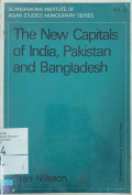
The New Capitals of India, Pakistan and Bangladesh
The book The New Capitals of India, Pakistan and Bangladesh explores the planning and development of new capital cities in three South Asian countries—India, Pakistan, and Bangladesh—after gain…
- Edisi
- Ed. 1, Cet. 2
- ISBN/ISSN
- 0-7007-0061-5
- Deskripsi Fisik
- 230 hal.; ilus.; 15,5 x 22,3 cm.
- Judul Seri
- -
- No. Panggil
- 711.4 NIL t
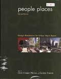
People Places: Design Guidelines for Urban Open Space
A resurgence in the use of public space continues throughout North America and many other parts of the world. Neighborhoods have become more outspoken in their demands for appropriate park designs;…
- Edisi
- Ed. 2, Cet. 1
- ISBN/ISSN
- 0-471-28833-0
- Deskripsi Fisik
- xiii, 367 hal.; ilus.; 21,4 x 28 cm.; indeks.
- Judul Seri
- -
- No. Panggil
- 711.4 MAR p
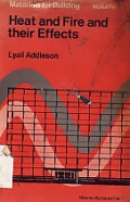
Heat and Fire and Their Effects
The book Heat and Fire and Their Effects by Lyall Addleson provides a comprehensive analysis of the impact of heat and fire on various materials and structures. It discusses the fundamental princip…
- Edisi
- Ed. 1, Cet. 1
- ISBN/ISSN
- 0-408-00171-2
- Deskripsi Fisik
- 181 hal.; ilus.; 21,7 x 30,3 cm.; indeks.
- Judul Seri
- Materials for building Volume 4
- No. Panggil
- 621.402 ADD h
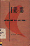
Finishing Material and Methods
The book Finishing: Materials and Methods provides a comprehensive overview of various materials and methods used in the finishing process, applicable to wood, metal, and other materials. The autho…
- Edisi
- Ed. 1, Cet. 1
- ISBN/ISSN
- -
- Deskripsi Fisik
- x, 320 hal.; ilus.; 15,7 x 23,6 cm.; indeks.
- Judul Seri
- -
- No. Panggil
- 698 SOD f

GIS Tutorial for Marketing
The value of geographic information system (GIS) technology for the business and marketing industry has never been greater than it is today. Small and large businesses alike are finding GIS to be a…
- Edisi
- Ed. 1, Cet. 10
- ISBN/ISSN
- 978-1-58948-079-7
- Deskripsi Fisik
- xxi, 409 hal.; ilus.; 24 x 27,7 cm.
- Judul Seri
- -
- No. Panggil
- 658.800285 MIL g
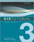
GIS Tutorial 3: Advanced Workbook
GIS Tutorial 3: Advanced Workbook features exercises that demonstrate the advanced functionality of the ArcEditor and ArcInfo licenses of ArcGIS Desktop. This workbook is divided into four sections…
- Edisi
- Ed. 1, Cet. 15
- ISBN/ISSN
- 978-1-58948-207-4
- Deskripsi Fisik
- x, 401 hal.; ilus.; 20,5 x 25,5 cm.
- Judul Seri
- -
- No. Panggil
- 910.285 ALL g

 Karya Umum
  Filsafat
  Agama
Agama  Ilmu-ilmu Sosial
  Bahasa
  Ilmu-ilmu Murni
  Ilmu-ilmu Terapan
  Kesenian, Hiburan, dan Olahraga
  Kesusastraan
  Geografi dan Sejarah