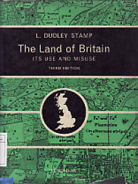
Textbook
The Land of Britain its Use and Misuse
Though the field. work of the Land Utilisation Survey was mainly completed in the three years 1931 to 1933 (as shown on Fig. 2, p. 9) and statistics based on its findings are best compared with official figures for 1932, the completion of some of the remoter areas of Highland Britain took place in later years, but as these delayed results were in hill areas of little change, the statement that the Survey refers mainly to 1931 to 1933 remains correct. The editing of the field sheets, preparation of manuscript one-inch maps, and the publication of all the sheets to cover England and Wales and the more populous parts of Scotland, together with some sample High- land areas, the writing and publication of 93 county reports occupied many years. The last of the reports was issued in December 1946, the last of the maps in 1949.
Ketersediaan
| 0000007900 | 711.42 STA t | Library Pusperkim | Tersedia |
Informasi Detail
- Judul Seri
-
-
- No. Panggil
-
711.42 STA t
- Penerbit
- London : Longmans., 1963
- Deskripsi Fisik
-
viii, 546 hal.; ilus.; 22,5 x 28,5 cm.; indeks.
- Bahasa
-
Inggris
- ISBN/ISSN
-
-
- Klasifikasi
-
711.42
- Tipe Isi
-
text
- Tipe Media
-
-
- Tipe Pembawa
-
-
- Edisi
-
Ed. 3, Cet. 1
- Subjek
- Info Detail Spesifik
-
-
- Pernyataan Tanggungjawab
-
-
Versi lain/terkait
Tidak tersedia versi lain
Lampiran Berkas
Komentar
Anda harus login sebelum memberikan komentar
 Karya Umum
  Filsafat
  Agama
Agama  Ilmu-ilmu Sosial
  Bahasa
  Ilmu-ilmu Murni
  Ilmu-ilmu Terapan
  Kesenian, Hiburan, dan Olahraga
  Kesusastraan
  Geografi dan Sejarah