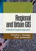
Regional and urban GIS : A Decision support approach
This unique text shows students and professionals how geographic information systems (GIS) can guide decision making about complex community and enviromental problems. The authors' step-by-step int…
- Edisi
- Ed. 1, Cet. 9
- ISBN/ISSN
- 978-1-60623-336-8
- Deskripsi Fisik
- xvi; 299 hal.; ilus.; 18 x 25 cm.
- Judul Seri
- -
- No. Panggil
- 910.1 NYE r
Spatial Analysis: Modelling in a GIS Environment
Spatial Analysis: Modelling in a GIS Environment Edited by Paul Longley and Michael Batty Digital data and information are used increasingly by academics, professionals, local authorities, and gove…
- Edisi
- Ed. 1, Cet. 1
- ISBN/ISSN
- 978-0-470-23615-4
- Deskripsi Fisik
- viii, 392 hal.; ilus.; 15,8 x 23,6 cm.; indeks.
- Judul Seri
- -
- No. Panggil
- 910.1 LON s
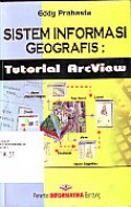
Sistem Informasi Geografis: Tutorial ArcView
Buku ini memberikan informasi mengenai tutorial pengerjaan sistem informasi geografis menggunakan perangkat lunak ArcView. ArcView merupakan salah satu perangkat lunak desktop sistem informmasi geo…
- Edisi
- Ed. 1, Cet. 2
- ISBN/ISSN
- 979-3338-00-8
- Deskripsi Fisik
- xvi, 456 hal.; ilus.; 16 x 24 cm.
- Judul Seri
- -
- No. Panggil
- 910.1 PRA s
Sistem Informasi Geografis
Buku ini membahas tentang konsep dasar Sistem Informasi Geografis (SIG). Buku ini terdiri atas 3 bagian, yang dibagi dalam 9 bab. Materi yang disajikan mencakup: definisi, komponen, fungsi dan manf…
- Edisi
- Ed. 1, Cet. 1
- ISBN/ISSN
- 978-602-262-118-8
- Deskripsi Fisik
- viii, 186 hal.; ilus.; 21 x 26 cm.
- Judul Seri
- -
- No. Panggil
- 910.285 IND s

Geografi Budaya Dalam Wilayah Pembangunan Daerah Kalimantan Selatan
"Buku ""Geografi Budaya Dalam Wilayah Pembangunan Daerah Kalimantan Selatan"" mengeksplorasi hubungan kompleks antara budaya dan pembangunan regional di Kalimantan Selatan. Buku ini menganalisis ba…
- Edisi
- Ed. 1, Cet. 1
- ISBN/ISSN
- -
- Deskripsi Fisik
- xi, 100 hal.; ilus.; 15,5 x 23 cm.
- Judul Seri
- -
- No. Panggil
- 910.59836 AHM g
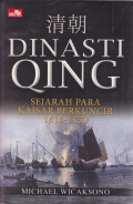
Dinasti Qing : Sejarah Para Kaisar Berkuncir 1616-1850
Perjalanan dinasti Qing dari kaisar pertama hingga terakhir kaisar terakhir selama lebih dari dua abad mengajarkan kepada kita, bahwa kemakmuran sebuah negeri benar-benar tergantung pada penguasa d…
- Edisi
- Ed. 1, Cet. 1
- ISBN/ISSN
- 978-602-02-72641
- Deskripsi Fisik
- xxvii, 522 hal.; ilus.; 14 x 21 cm.
- Judul Seri
- -
- No. Panggil
- 951 WIC m
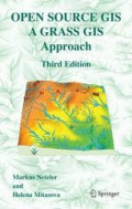
Open Source GIS A Grass GIS Approach
"With this third edition of Open Source GIS: A GRASS GIS Approach, we enter the new era of GRASS6, the first release that includes substantial new code developed by the International GRASS Developm…
- Edisi
- Ed. 3, Cet. 1
- ISBN/ISSN
- 978-1-4419-4206-7
- Deskripsi Fisik
- 406 hal.; ilus.; 15,5 x 23,5 cm.; indeks.
- Judul Seri
- -
- No. Panggil
- 910.02 NET o
Making Spatial Decisious Using GIS a Workbook
This college-level textbook gives students skills and knowledge that will help them incorporate GIS and remote sensing into decision making as they pursue careers in government, business, and other…
- Edisi
- Ed. 2, Cet. 1
- ISBN/ISSN
- 978-1-58948-280-7
- Deskripsi Fisik
- xxi, 158 hal.; ilus.; 20,5 x 25,5 cm.
- Judul Seri
- -
- No. Panggil
- 910.02 KER m
GIS Tutorial 3: Advanced Workbook
GIS Tutorial 3: Advanced Workbook features exercises that demonstrate the advanced functionality of the ArcEditor and ArcInfo licenses of ArcGIS Desktop. This workbook is divided into four sections…
- Edisi
- Ed. 1, Cet. 15
- ISBN/ISSN
- 978-1-58948-207-4
- Deskripsi Fisik
- x, 401 hal.; ilus.; 20,5 x 25,5 cm.
- Judul Seri
- -
- No. Panggil
- 910.285 ALL g
Getting to Know ArcGIS: ModelBuilder
Getting to Know ArcGIS Model Builder teaches readers how to develop reusable geoprocessing workflows and run these programs as models. Written for intermediate and advanced GIS users, Getting to Kn…
- Edisi
- Ed. 1, Cet. 15
- ISBN/ISSN
- 978-1-58948-255-5
- Deskripsi Fisik
- viii, 320 hal.; ilus.; 19 x 23 cm.
- Judul Seri
- -
- No. Panggil
- 910.285 ALL g
 Karya Umum
  Filsafat
  Agama
Agama  Ilmu-ilmu Sosial
  Bahasa
  Ilmu-ilmu Murni
  Ilmu-ilmu Terapan
  Kesenian, Hiburan, dan Olahraga
  Kesusastraan
  Geografi dan Sejarah